
By: Audrey Raymonda John
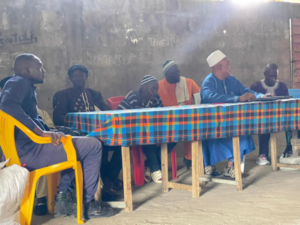
Statistics Sierra Leone (Stats SL) recently conducted a key stakeholder engagement meeting in Mara Chiefdom, Bombali District, Northern Sierra Leone. This event marked one of the three rural sites selected for the national Pilot Cartographic Mapping exercise.
During the meeting, Chiefdom Speaker Pa Mustapha Jalloh welcomed the Stats SL delegation, expressing appreciation for the collaboration and reaffirming the chiefdom’s ongoing support for the field teams. “Mara has wholeheartedly hosted Stats SL field staff since their arrival, and we will continue to do so,” he stated.
The Paramount Chief, PC Bai Bairoh Mabolleh Anshami III, expressed pride that Mara Chiefdom was the only location selected in the entire northern region for this pioneering pilot initiative. He urged community members to cooperate fully and encouraged local leaders to raise awareness about the project throughout the chiefdom. “Our people should see the field staff as one of their own,” he emphasized.
Samuel Ansumana, Director of Communication and Public Relations at Statistics Sierra Leone, thanked the paramount chief and stakeholders for their warm welcome. He highlighted the importance of community engagement, stating, “We urge you to go beyond your constituents bring this message to every household.”
Amadu Sheriff, Principal Statistician for the Northern Region and field team leader in Mara, assured community leaders that his team would observe all local protocols. “We will take utmost care to respect the traditions and culture of the chiefdom to foster cooperation and trust,” he assured.
Representatives in attendance included local leaders and stakeholder representatives such as Chiefdom Youth Leader Hassan S. Kamara, Section Chief Pa Alimamy Turay, Mammy Queen Ya Amie Tarawalie, Farmer Representative Ibrahim Sorie Tholley, Headman Sullay Tarawalie, and Police Representative Abdul Kamara. Also present were Chiefdom Imam Pa Alhaji Abu Bakarr Tholley, women’s leaders, members of the bike riders’ union, and other community members.
The Pilot Cartographic Mapping is a preparatory geographic data collection exercise designed to test tools and methods ahead of the nationwide census cartography. The pilot is being conducted in four strategically selected locations:
Kissy Teng Chiefdom – Disputed border area
Dema Chiefdom – Hard-to-reach terrain
Mara Chiefdom – Easily accessible rural area
Freetown East II and III – Urban and accessible areas
This exercise aims to identify logistical, technical, and community engagement challenges, while training teams and refining field strategies for the upcoming national rollout.